Roads and Transporatation
Concerns include public safety with semi-trucks, chemical trucks, and over-sized loads on public roads and haul trucks on public Forest lands and.
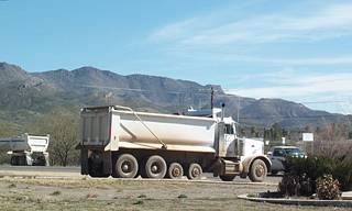
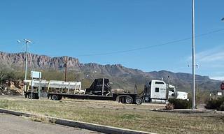
Trucks on public roads at Arizona mine
AZ-83 Roadway Assessment by Rosemont Copper
SR-83 Issues to presented to Congressional staff
Letter to ADOT from James Kramp
Summary of issues of the Roadway Assessment by Mountain Empire Action Alliance:
Following is a summary of the report titled �AZ-83 Rosemont Assessment� prepared for Rosemont Copper by Tetra Tech and released in July 2009. The transportation sub-committee of the Mountain Empire Action Alliance (MEAA) prepared this summary of concerns.
The AZ-83 Rosemont Assessment report consists of an Executive summary, an introduction describing the Rosemont mine project, a section concerning current AZ-83 roadway assessment, a section analyzing and comparing accident occurrences on AZ-83 and AZ-77, and a section outlining potential roadway improvements.
According to the Executive summary � The proposed Primary Access Road leading to the Rosemont Project off AZ-83 is located at MP 46.9. This location shows relatively low accident frequency and rate. � The report fails to mention that the sixth most accident-prone location is at MP 47, one tenth of a mile from Rosemont's proposed primary access road. The top five (5) accident-prone locations are located at � Mile Post (MP) 44, 45, 46, 55, and 58. In particular, the roadway segment between MP 44.5 to 44.0 has the highest accident frequency for all fatal accidents along AZ-83. Additionally, locations where substandard designs are present coincide with the high accident frequency locations. � When I analyzed the ADOT accident statistics from 3/01/2002 to 2/28/2007 almost 2 years ago I found 10 accidents reported at MP 47. Tetra Tech only reports 7 accidents from 2003 to 2008. Either 3 accidents occurred from 3/1/2002 to 12/31/2002, or a mistake was made. If the 3 accidents had been included then MP 47 would be tied with MP 58 for the 4 th most accident-prone location. The only significant changes proposed for the substandard, accident-prone locations are would be changes to AZ-83 at MP 44 where the majority of accidents occur.
Several substandard elements were identified in Section 2 �Roadway assessment.� They include:
1. Tight reverse horizontal curves are identified in Table 2.1 of the report.
1.1 At Hilton Ranch Rd, AZ-83 intersection (MP 49.1), a substandard horizontal curve exists. Section 2.2.3. 2 states � Near the Hilton Ranch Road and AZ-83 intersection, the combination of a hill and a horizontal curve contribute to a substandard sight distance at this location . The alignment in the vicinity of Hilton Ranch Road is also a concern because the intersection is on blind curve, which makes southbound left turn movements from AZ-83 onto Hilton Ranch Road difficult. Based on the curve data in Table 2.2, this area also has a substandard horizontal curve alignment . Therefore, the fairly sharp curve, coupled with a steep slope, heavy vegetation, and no shoulder, contributes to the poor sight distance at this intersection. Finally, the roadway pavement ends less than one (1) foot beyond the white edge stripe causing shoulder deterioration. � No improvements are suggested to mitigate these problems beyond a potential shoulder improvement and by adding a bus pull-off area on this dangerous blind curve and intersection.
1.2 At MP 47.7, 47.6, and 47.5 tight reverse horizontal curves. MP 47 is the 6 th highest accident location according to the report using data from 2003 to 2008 provided by the ADOT. No improvements are suggested to mitigate this problem in the report.
1.3 At MP 44.1, 44.2, 44.3 tight reverse horizontal curves. ADOT is addressing this a s part of the ADOT Safety Project, � the horizontal curves within this roadway segment will be realigned, fixing the substandard curve radii. The project will also replace the existing substandard guardrails, widen the roadway shoulders, flatten the road cuts, and install new signs and striping. These improvements will increase the motorist sight distance and the overall safety of this roadway segment. This safety project is identified as Tracs number H705701C and ADOT project number 083-A(200)A. As of April 14, 2009, the project was still waiting for environmental clearance.� Improvements will be paid for by the taxpayers as part of the HES (hazard elimination system) federal funds.
2. Improper guardrail placement Section 2.5 states � Most of guardrails along AZ-83 fail to meet ADOT design standards since they are outdated and located too close to the edge of the paved roadway.� According to the report these guardrails are reported present throughout the AZ-83 study area between MP 33 and 52. However, the illustration 2.12 shows an example of a typical substandard guardrail at the Sahaurita Rd intersection (MP 55, substandard guardrails are present in areas other than between MP 33 and 52). No improvements are identified to mitigate this problem in the report. Section 4.0 the report states that � all potential roadway improvements were designed not to affect existing utilities or guardrails.� Without proper guardrail placement roadway shoulder's cannot be widened.
3. Insufficient roadway shoulder widths . Section 2.6 states the shoulders along AZ-83 are cracked and at most locations the width is less than the standard required 6-foot width. Section 4.6 suggests that � one of the planned ADOT projects highlighted in Section 2.6 focuses on upgrading shoulders to the required standards .�
3.1 The only reference to an ADOT project to widen AZ-83 shoulders is mentioned in the AZ-83 MP 44 to 45.5 Safety project which states � The project will also replace the existing substandard guardrails, widen the roadway shoulders, flatten the road cuts, and install new signs and striping .� I checked ADOT's website and find no reference to a project on AZ-83 to widen the shoulders. The report would imply that ADOT has plans to fix the shoulders along AZ 83, not just a 1.5 mile stretch of them. It is not clear if Rosemont is proposing to improve the roadway shoulders that are not being improved by the ADOT plan.
4. Insufficient sight distance. The stopping sight distance for horizontal curves is evaluated by examining the potential obstructions along the inside region of a curve. These are the problem areas identified in the report.
4.1 The AZ-83 and Hilton Ranch Rd intersection was found to be unsafe. � Near the Hilton Ranch Road and AZ-83 intersection, the combination of a hill and a horizontal curve contribute to a substandard sight distance at this location . The alignment in the vicinity of Hilton Ranch Road is also a concern because the intersection is on blind curve, which makes southbound left turn movements from AZ-83 onto Hilton Ranch Road difficult .� No improvements are suggested to mitigate these problems beyond a potential shoulder improvement accomplished by adding a bus pull-off area on this dangerous blind curve and intersection.
4.2 � A tight horizontal reverse curve (Illustration 2.7), combined with a 6% downgrade, deteriorates the sight distance along AZ-83 between MP 44 and 46. Moreover, the steep road cuts within this area also obstruct the sight distance along the horizontal curves .� The AZ-83 MP 44 to 45.5 Safety project does not identify increased sight distance as a result of the improvement
5. Lack of existing School bus stops The report identified seven existing bus stops. � With the exception of the Hilton Ranch Road school bus stop, the bus stops do not have a pull-off area along AZ-83 (i.e., the buses stop within the through lane of AZ-83). At the Hilton Ranch Road school bus stop, a wide compacted dirt area was observed on the east side of AZ-83 .� The report recommends seven school bus stop pull off areas be constructed at the current bus stop locations to improve traffic flow. The recommended bus stop at Hilton Ranch Rd directly follows a substandard curve with limited sight distance. The bus will be susceptible to rear end collisions if NB traffic travels into the pull off area for any reason.
6. Lack of existing wide load truck turnouts Currently no truck turnouts exist on AZ-83. Two wide load truck turnouts are suggested . One proposed just south of the Sahaurita/AZ-83 intersection on the west side of AZ-83 (SB traffic side). Another is proposed at MP 47.2 just north of the proposed primary access road .
The AZ-83 Accident analysis summary in Section 3.7 of the report states � the major causes of accidents on AZ-83 are speeding along with the curvy roadway geometry. Additionally, the narrow roadway shoulder and lack of adequate pull off locations along AZ-83 adds to the safety issues since it prevents slow moving vehicles from pulling over and allowing cars to pass. The narrow shoulder and lack of pullouts are also safety concerns for tourists who want to enjoy the scenic views along AZ-83.�
7. Concerns with the Rosemont access road intersection with SR-83
The proposed Access road intersection with SR-83 was studied by Quentin Lewton, former Truck Driver Advocate, Citizens for Reliable and Safe Highways
Quentin Lewton
PO Box 207
Sonoita AZ 85637
Given the volume of traffic the proposed access road to SR 83 at mile post 46.9 from Augusta Resource's proposed mine creates at least 5 engineered hazards as per Tetra Tech; Existing Primary Access Road Photos, Figure no.: 3.
Before specifying the hazards involved with the Access Road please keep the following facts in mind:
- One thousand (1,000) automobiles a year are involved in under ride crashes � 2% of automobile occupants survive this type of crash.
- At 65 mph the stopping distance for an automobile is 162 feet in dry conditions.
- At 65 mph the stopping distance for a semi tractor trailer is 420 feet in dry conditions.
- From the time the driver of a tractor trailer steps on the brakes (air brakes) there is a 1 second lag before braking begins to take effect.
- Nominally an automobile accelerates from 0 � 60 mph in 12 seconds.
- Nominally a truck takes more than a minute to accelerate from 0 � 60 mph.
State Route 83 is State Scenic Route with an increasing number of commuters, tourists' recreational vehicles and service vehicles traveling to and from the Sonoita, Elgin and Patagonia areas.
Engineered Hazard #1:
There is no northbound truck acceleration lane.
Engineered Hazard #2:
Southbound traffic on SR 83 approaching the �Primary Access Road� will come up a slight rise just north of mile marker (mm) 47 and subsequently the sight of both a motorist traveling south and a truck driver waiting travel at the �T� intersection and SR 83 is impaired.
Drawing a straight line from the stop line and the center line of the Access Road shows that a truck driver's line of sight to be potentially obscured for southbound traffic � the same applies for the truck driver looking for northbound traffic. The driver will actually be sitting back some distance from the stop line of the Access Road by virtue of the driver's seat placement in the tractor cab. A clear field of view of the truck driver is further obscured by southbound trucks exiting SR83 onto the Access Road. The situation is further exacerbated by the much too short deceleration lane for exiting trucks, and in the case of a congestion of trucks exiting, some trucks could be left blocking the main southbound travel lane of SR 83. Automobile drivers will, as is the habit, move to the left portion of the southbound travel lane in order to better speed their travel all out of sight of the trucks waiting to head north on SR 83 from the Access Road. The truck driver waiting at the stop line at the Access Road will be continually swiveling his head almost 180 degrees trying to pick a safe point to head either north or south on SR 83.
Engineered Hazard #3:
The truck driver makes a determination that it is safe to proceed from the stop line at the Access Road based on what he can see behind trucks exiting from south bound SR 83 not realizing that a car maybe out of view. As the truck driver proceeds away from the stop line, swiveling his head to check for northbound traffic when suddenly either the southbound vehicle recognizes the danger of a collision or the truck driver does. The question is can the truck and / or the automobile stop in time? Does the car try to avoid a collision by swerving into northbound traffic? Or suffer the consequences of an under ride crash in which the fatality rate is 98%.
Engineered Hazard #4:
A northbound truck proceeds from a dead stop from the Access Road stop line across the southbound lane of SR 83. Depending on the weather, the angle of the sun or day or night the possibility of an under ride crash is high. An automobile driver can be partially blinded by the sun and not observe truck, van or flat bed, that should not have moved away from the stop line. The situation is particularly exacerbated by the sun's angle and night time travel. A southbound automobile driver can be partially blinded by northbound traffics' lights and not see a truck's trailer, van or flatbed, blocking his southbound lane. An exiting truck can have its small running light out making the trailer virtually invisible at night or a low on the horizon sun angle. An automobile's headlights shine below the bed of a trailer. A flatbed trailer is more problematic because it presents an even lower visibility profile from on edge; as an automobile driver would see it.
Most of the above hazards will apply to northbound traffic as well.
Engineered Hazard #5:
Southbound trucks exiting from the Primary Access Road will not gain highway speeds in the acceleration lane before merging onto single lane SR 83. The southbound acceleration lane is of insufficient length.
From the Access Road at mile post 46.9; Southbound trucks will not be able to build speed of 55 mph before the grade at about mile post 46.7. Laden trucks will never build highway speeds climbing the grade until somewhere beyond mile post 43. Trucks pulling the grade southbound are unlikely to pull the grade any faster than 30 mph, some as low 15. There are no lanes provided for slow moving truck on the southbound grade. This creates a hazard for rear under ride crashes on corners and the possibility of autos not having enough distance to pass in the passing zones now provided on the grade before collisions with northbound cars or too soon attempts to remerge with the southbound truck. There is no break down lane north or south bound on the grade. Laden trucks that do need to stop will create an obstruction in the travel lane, particularly southbound, on SR 83.
In conclusion, the July 2009 Tetra Tech; Existing Primary Access Road proposal is poorly thought out, and has been done on the cheap at the expense of the motoring publics' safety.
After assessing AZ-83 for substandard design issues the following locations/issues are left unmitigated:
- Narrow roadway shoulders are identified as a safety issue. The report implies the ADOT has a project to improve them, but no reference to a project can be found in the report or on the ADOT website. Does Rosemont plan on improving them?
- Guardrails are identified as improperly placed, yet nothing is suggested to mitigate it.
- The Hilton Ranch Road intersection with AZ-83 is identified as unsafe for a variety of reasons, yet nothing is suggested to mitigate them.
- The Sahaurita Rd intersection with AZ-83 is listed in the top 5 accident locations, yet nothing is suggested to improve the intersection.
- The AZ-83 interchange with I-10 is listed in the top 5 accident locations, yet nothing is suggested to improve the interchange, nor was it considered in the report.
- Poorly thought out SR-83 access proposals.
Haul Trucks on Public Lands:
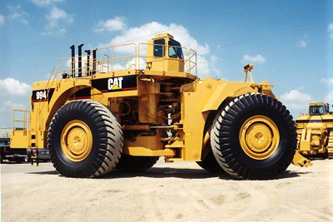
Haul Truck to haul ore from pit to mill on public land
These haul trucks are so heavy they are not allowed on public roadways, yet they will be going across public lands. In a Federal District Court in Oregon , environmental groups sued the Forest Service for violations of the Clean Water Act due to small mining operations�not big pits and waste piles with huge haul trucks.
Excerpts from case Opinion and Order:
Page 1-2
Plaintiffs challenge the Record of Decision (ROD) for the North Fork Burnt River Mining Project (Project) in the Wallowa-Whitman National Forest (WWNF) in Eastern Oregon . Plaintiffs allege the U.S. Forest Service (Forest Service) violated the National Forest Management Act (NFMA), 16 U.S.C. §§ 1600 et seq., the National Environmental Policy Act (NEPA), 42 U.S.C. §§ 4321 et seq., the Clean Water Act (CWA), 33 U.S.C. § 1251 et seq., the Forest Service Organic Administration Act of 1897 (Organic Act), 16 U.S.C. § 478, 551, and the Defendants Richard Haines and Steve Ellis are sued in their official capacity as a WWNF unit ranger and WWNF forest supervisor. For clarity, defendants will be referred to as the Forest Service. Administrative Procedures Act (APA), 5 U.S.C. §§ 501-701. This court has jurisdiction under 28 U.S.C. § 1331.
Five streams in the watershed have been listed as water-quality impaired under § 303(d) of the Clean Water Act due to high temperatures and/or sedimentation. Three of these streams are involved in this matter in that nineteen projects detailed in the ROD are or will be located on these three streams. The ROD identifies the following activities as negatively affecting water quality in the watershed: timber harvest, road building, and mining. Redband trout, Columbia spotted frog and three plant species that exist in the area are all on the Regional Forester's list of sensitive species. There are 747 miles of road�some open, some closed�in the watershed, mostly built to serve mining operations. The NFBR Roads Analysis identified 241 of these miles as contributors to water quality problems. Road densities throughout the NFBR watershed exceed road density limitations established in the Forest Plan. If all 49 projects in the FEIS are approved, the mining operations will disturb 116 acres in the WWNF, 64 of them in riparian areas.
Page 11-12
The Forest Service argues that Alternative 4's contemplation of road closures and decommissionings will reduce road-related sedimentation and improve water quality.
Alternative 4 proposes the following activities to forest system roads recognized as contributing to water degradation: closing approximately 63 miles of roads currently used for mining access, maintenance on approximately 15 miles of roads, reconstructing approximately 24 miles of roads, and decommissioning approximately 11 miles of roads. AR 8057; FEIS II-39. Roads are the largest contributor of activity-generated sediment in the watershed. AR 7950; ROD at 15.
Page 20: CONCLUSION
For the reasons set forth above, plaintiffs' motion for summary judgment (# 35) is granted as to the claims under the Clean Water Act, the Organic Act, and the National Forest Management Act. Defendant's motion for summary judgment (# 50) is granted as to the claims under the National Environmental Policy Act. The Forest Service is enjoined from allowing mining or mineral operations in the North Fork Burnt River pursuant to the NFBR Record of Decision and Final Environmental Impact Statement issued in April 2004 for any action that this court has found violates the CWA, the Organic Act, NFMA and the implementing laws and regulations of those acts.
Dated this 4th day of August, 2006.
/s/ Paul Papak
Honorable Paul Papak